INTRODUCING
BOOKINGS ON WIKICAMPS
Trayning Well
 Point of Interest
Description
Wheatbelt Way Site 22
In 1869, John Forrest named the local water source at Trayning, which was his spelling of the local Aboriginal name Duri-iring, a combination of two words meaning to crawl and a camping place. Duranning was eventually corrupted to Trayning. The Aboriginal knowledge of waterholes was essential for early explorers and settlers survival and many soaks and wells retained their Aboriginal name after European settlement.
On 1 March 1879, the Toodyay Road Board accepted the tender of Charles Adams for the sinking of a well at Trayning. In the 1887 survey, the place was described as:
Good supply of water at present, but not permanent. It is a tank excavated in the ground 10 feet in diameter by 14 feet deep stoned up with stone and covered over with saplings. A small gully is turned into it, which it fills whenever a thunderstorm occurs. This could be improved by enlarging; very good place for a tank.
The Trayning Well was an important source of water on the Yarragin Road to the Yilgarn Goldfields and for early settlers. Take the time to stop at Trayning Well to admire the workmanship of Charles Adam in the art of sinking and lining a well by hand in the late 1800s.
Find this site and more on WikiCamps
Take the ultimate camping companion on your next trip, with these great features:
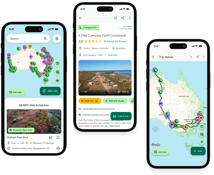
![]() Explore more than 60,000 sites across Australia with detailed site information at your fingertips
Explore more than 60,000 sites across Australia with detailed site information at your fingertips
![]() Stay in the know with exclusive, insightful reviews from fellow travellers
Stay in the know with exclusive, insightful reviews from fellow travellers
![]() Map journeys, plan your route, and gauge your fuel spend with Trip Planner
Map journeys, plan your route, and gauge your fuel spend with Trip Planner
![]() No signal? No worries! Use offline mode to travel anywhere with WikiCamps
No signal? No worries! Use offline mode to travel anywhere with WikiCamps
![]() Add sites to your collections, search with intuitive filters, and so much more...
Add sites to your collections, search with intuitive filters, and so much more...
Get WikiCamps now!
Download WikiCamps from the App Store on your device.

