INTRODUCING
BOOKINGS ON WIKICAMPS
Trayning Gnamma Holes
 Point of Interest
Description
The Wheatbelt Way Site 23
The Trayning Gnammas are located 18km north of Trayning and they are some of the largest in the district. Gnammas are the name for watering holes given by the aboriginal people. The Wheatbelt Way region has been home to many Aboriginal groups for millennia, giving it a rich cultural diversity and history. The three main tribal family groups are the Ballardong people (Northam to Wyalkatchem) Kelamaia (out near Mukinbudin to Southern Cross) and the Njaki Njaki (Trayning to Merredin) that tended to congregate around local water holes usually associated with Granite Outcrops, depending on the seasons and conditions.
This site marks the boundary of the Ballardong and Njaki Njaki people and was a source of water for Aboriginal people of the area as they moved from place to place, as well as being a vital water supply for the early explorers and settlers of the district. Birds and other wildlife frequent the area and the perimeters of the granite near the gnammas are good places to search for orchids and wildflowers during the springtime.
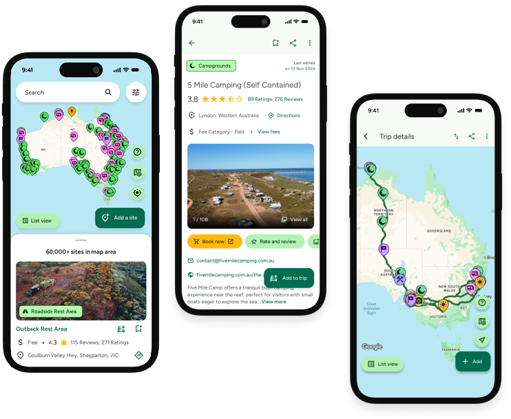
Find this site and more on WikiCamps
Take the ultimate camping companion on your next trip, with these great features:
![]() Explore more than 60,000 sites across Australia with detailed site information at your fingertips
Explore more than 60,000 sites across Australia with detailed site information at your fingertips
![]() Stay in the know with exclusive, insightful reviews from fellow travellers
Stay in the know with exclusive, insightful reviews from fellow travellers
![]() Map journeys, plan your route, and gauge your fuel spend with Trip Planner
Map journeys, plan your route, and gauge your fuel spend with Trip Planner
![]() No signal? No worries! Use offline mode to travel anywhere with WikiCamps
No signal? No worries! Use offline mode to travel anywhere with WikiCamps
![]() Add sites to your collections, search with intuitive filters, and so much more...
Add sites to your collections, search with intuitive filters, and so much more...
Get WikiCamps now!
Download WikiCamps from the App Store on your device.

