INTRODUCING
BOOKINGS ON WIKICAMPS
Narkeening Gnamma Hole
 Point of Interest
Description
The Narkeening Water Reserve No. 11212 was originally declared on November 20th 1908, and the Narkeening Gnamma Hole is shown on an early twentieth century map as part of that reserve. The smoothly irregular shape of the hole bears testimony to the method of construction, with hollows that suggest that fires had been lit to crack the rock. Some of the cavities were part the way up the walls of the gnamma hole, and water from the lower cavities would have been available to splash on to the hot rock to assist the process of cracking and flaking.
The aboriginal people had to learn survival skills such as the protection and management of water holes. When Surveyor J.S.Roe explored the district in 1836, he noted that there was a good spring at Knungajin which had been deepened out to a well by the natives, and in 1864 Surveyor Charles Hunt noted that many existing waterholes throughout the area had been carefully covered with sticks and branches to protect the water from native dogs and other animals.
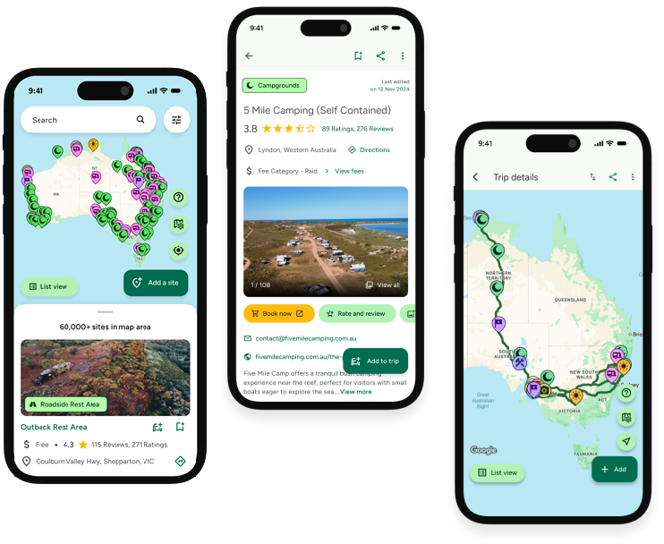
Find this site and more on WikiCamps
Take the ultimate camping companion on your next trip, with these great features:
![]() Explore more than 60,000 sites across Australia with detailed site information at your fingertips
Explore more than 60,000 sites across Australia with detailed site information at your fingertips
![]() Stay in the know with exclusive, insightful reviews from fellow travellers
Stay in the know with exclusive, insightful reviews from fellow travellers
![]() Map journeys, plan your route, and gauge your fuel spend with Trip Planner
Map journeys, plan your route, and gauge your fuel spend with Trip Planner
![]() No signal? No worries! Use offline mode to travel anywhere with WikiCamps
No signal? No worries! Use offline mode to travel anywhere with WikiCamps
![]() Add sites to your collections, search with intuitive filters, and so much more...
Add sites to your collections, search with intuitive filters, and so much more...
Get WikiCamps now!
Download WikiCamps from the App Store on your device.

