INTRODUCING
BOOKINGS ON WIKICAMPS
Eastern Lookout & Bluff Knoll Trailhead
 Day Use Area
Description
Bluff Knoll
Class 4
Height: 1095m
Distance: 6km return
Allow three to four hours. Bluff Knoll is the highest peak in the southern half of WA and has the most popular trail in the park. Scale its heights to take in outstanding 360-degree views.
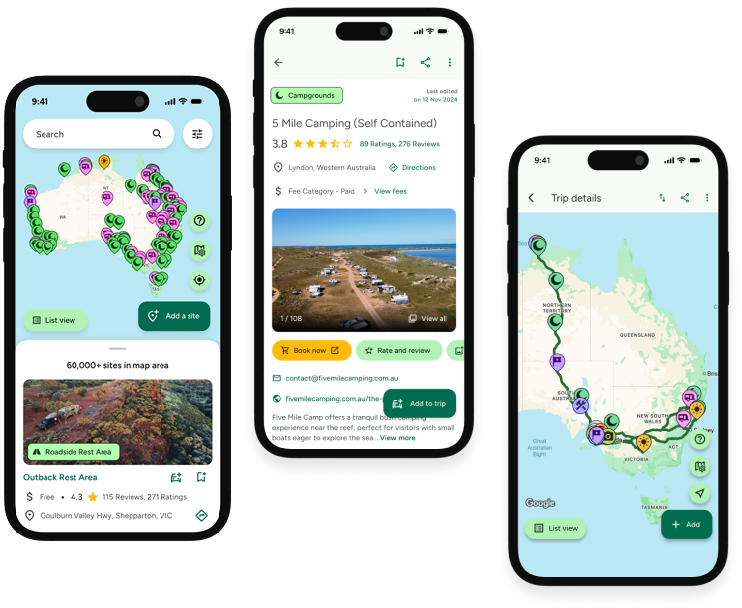
Find this site and more on WikiCamps
Take the ultimate camping companion on your next trip, with these great features:
![]() Explore more than 60,000 sites across Australia with detailed site information at your fingertips
Explore more than 60,000 sites across Australia with detailed site information at your fingertips
![]() Stay in the know with exclusive, insightful reviews from fellow travellers
Stay in the know with exclusive, insightful reviews from fellow travellers
![]() Map journeys, plan your route, and gauge your fuel spend with Trip Planner
Map journeys, plan your route, and gauge your fuel spend with Trip Planner
![]() No signal? No worries! Use offline mode to travel anywhere with WikiCamps
No signal? No worries! Use offline mode to travel anywhere with WikiCamps
![]() Add sites to your collections, search with intuitive filters, and so much more...
Add sites to your collections, search with intuitive filters, and so much more...
Get WikiCamps now!
Download WikiCamps from the App Store on your device.

