INTRODUCING
BOOKINGS ON WIKICAMPS
Rawnsly Bluff Car Park
 Day Use Area
Description
Starting point for various walking trails.
Rawnsley Bluff
DIFFICULT
Rawnsley Bluff (5 hr return) 12.6kms
Wilpena Lookout (4 hr return) 11.4kms
From the carpark the trail follows the creek bed for 600m before you begin climbing the foothills of the main range (Bonney Sandstone). The trail gradually steepens to a climb which brings you to Lone
Pine Lookout. From here, the worst of the climb is over and the trail becomes less steep as you approach the summit.
Left fork: Wilpena Pound Lookout 600m. Provides an excellent view down the centre of Wilpena Pound.
Right fork: Rawnsley Bluff 1.5km. Survey Cairn constructed by Samuel Parry 1858. View to the south and east overlooking Chace Range.
Twidale Top
EASY (45 min return) 2kms
The remnant flat-topped mesa is a good example of the erosion process that has shaped the Flinders landscape. Excellent views of Rawnsley Bluff escarpment and the caravan park and cabins.
Ferntree Falls
MODERATE (2 hr return) 5.2kms
Follow the Rawnsley Bluff track for 600m before branching off to the left. Pass through a low saddle before following a fence line that takes you to Ferntree Creek. Ferntree Falls flow only after heavy rain.
No camping or overnight parking.
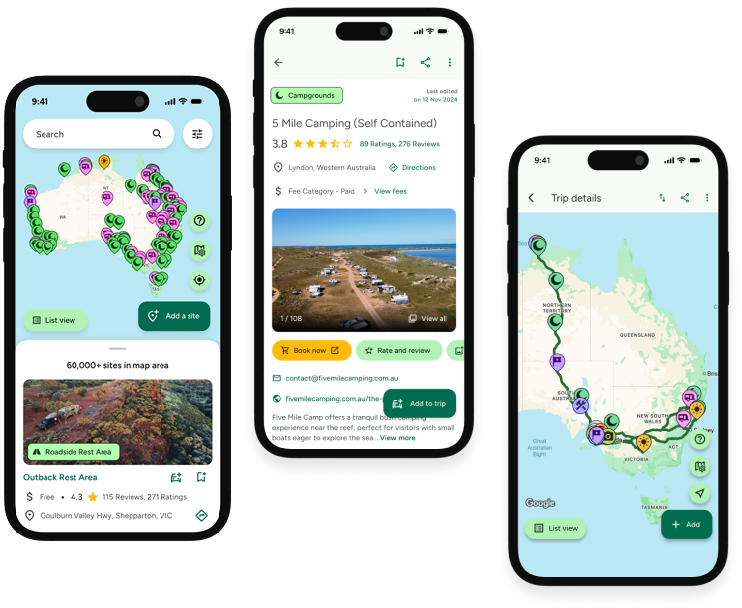
Find this site and more on WikiCamps
Take the ultimate camping companion on your next trip, with these great features:
![]() Explore more than 60,000 sites across Australia with detailed site information at your fingertips
Explore more than 60,000 sites across Australia with detailed site information at your fingertips
![]() Stay in the know with exclusive, insightful reviews from fellow travellers
Stay in the know with exclusive, insightful reviews from fellow travellers
![]() Map journeys, plan your route, and gauge your fuel spend with Trip Planner
Map journeys, plan your route, and gauge your fuel spend with Trip Planner
![]() No signal? No worries! Use offline mode to travel anywhere with WikiCamps
No signal? No worries! Use offline mode to travel anywhere with WikiCamps
![]() Add sites to your collections, search with intuitive filters, and so much more...
Add sites to your collections, search with intuitive filters, and so much more...
Get WikiCamps now!
Download WikiCamps from the App Store on your device.

