INTRODUCING
BOOKINGS ON WIKICAMPS
Redbank Gorge Day Use Area
 Day Use Area
Description
Located in the Tjoritja / West MacDonnell National Park and nestled at the base of Mount Sonder (Rutjupma, pronounced roo-choop-ma), this stunning gorge and chasm is a refuge for many threatened plant and animal species. For visitors travelling on the Red Centre Way, Redbank Gorge also provides a refreshing stop and a chance to stretch your legs on a short walk. Toilets and picnic facilities are available at the car park.
Redbank Gorge is located 156 km west of Alice Springs. Access is via
Larapinta and Namatjira Drives, both sealed roads. The 5 km access road from the Redbank Gorge turnoff to Redbank Gorge is unsealed and a high clearance vehicle is recommended. All roads can be impassable for a short period after heavy rain.
The Gorge has a near-permanent waterhole situated 1 km from the Carpark. Swimmers should be aware that most waterholes are extremely cold. It is recommended that swimmers use a flotation device to assist them in swimming through the Gorge. Prolonged exposure, even during summer, can result in hypothermia. Beware of submerged logs and rocks. Do not jump or dive into the water.
A grade 3 - moderate 2 km, 1.5 hour return walk from the carpark alongside the creekbed will lead visitors to Redbank Gorge. The walk is unmarked but starts on a well defined track before dropping into the sandy creek bed. On a warm day walking in the sand is tiring and visitors should take and drink plenty of water. The track is rocky at times and care should be taken when walking.
Section 12 of the Larapinta Trail starts and finishes at the Redbank Gorge Carpark.
Bins are not provided, please take your rubbish with you.
Pets are not permitted.
No camping or overnight parking.
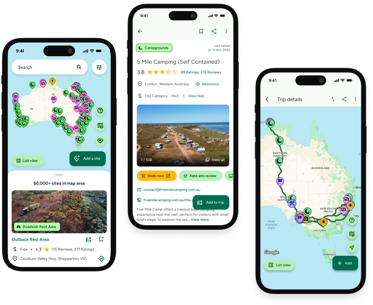
Find this site and more on WikiCamps
Take the ultimate camping companion on your next trip, with these great features:
![]() Explore more than 60,000 sites across Australia with detailed site information at your fingertips
Explore more than 60,000 sites across Australia with detailed site information at your fingertips
![]() Stay in the know with exclusive, insightful reviews from fellow travellers
Stay in the know with exclusive, insightful reviews from fellow travellers
![]() Map journeys, plan your route, and gauge your fuel spend with Trip Planner
Map journeys, plan your route, and gauge your fuel spend with Trip Planner
![]() No signal? No worries! Use offline mode to travel anywhere with WikiCamps
No signal? No worries! Use offline mode to travel anywhere with WikiCamps
![]() Add sites to your collections, search with intuitive filters, and so much more...
Add sites to your collections, search with intuitive filters, and so much more...
Get WikiCamps now!
Download WikiCamps from the App Store on your device.

